With over 50 years of experience, you can trust Balchen & Kulchycki Surveys in Dauphin for quality survey work, including legal descriptions, plans of easement, and more. Call us t...more...See more text
Digital Photogrammetry, Digital Mapping, Construction Surveyor, Construction Survey, Commercial Survey, Certificate Of Location, Cadastral Survey, Cadastral Plan, Cadastral Mapping, Air Space Subdivision
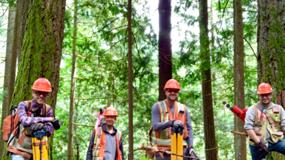
GeoVerra is Canada's leading surveying and geomatics firm, with a sweeping breadth of services in land surveying, forestry, environmental and advanced technologies. We are industry...more...See more text
Surveying, Construction Surveys, Control Surveys, Site Planning, Drone Surveys, LiDAR, 3D Laser Scanning, Pipeline Pre-Construction, Pipeline Construction Services, GIS and Remote Sensing, Pipeline Integrity, Renewable Energy Projects, Land Development Planning and Construction, Wellsite Surveys, Pipeline Surveys, Right of Way Surveys, Reclamation Surveys
Building Layout, Thematic Mapping, Easement Plan, Topographic Surveys, Water Level Monitoring, GPS Control, Surface Modeling, Subdivision, Staking Certificates, UAV (Drone), Building Location Certificates, Site Planning, Aerial Photography, Road Layouts, Planning Applications, Area Volume Calculations, Lot Grading Plans, Condominiums, Control Surveys
Richmond Surveys was established in 2012 and is owned and operated by commissioned Manitoba Land Surveyor, Steve Richmond. Based in Brandon, we provide land surveying services thro...more...See more text
Water Level Monitoring, GPS Control, Lot Grading Plans, Site Planning, Staking Certificates, Topographic Surveys, Building Location Certificates, UAV (Drone), Planning Applications, Condominiums, Easement Plan, Building Layout, Area Volume Calculations, Control Surveys, Aerial Photography, Surface Modeling, Road Layouts, Subdivision, Thematic Mapping
Richmond Surveys was established in 2012 and is owned and operated by commissioned Manitoba Land Surveyor, Steve Richmond. Based in Brandon, we provide land surveying services thro...more...See more text
Digital Photogrammetry, Digital Mapping, Construction Surveyor, Construction Survey, Commercial Survey, Certificate Of Location, Cadastral Survey, Cadastral Plan, Cadastral Mapping, Air Space Subdivision
Any construction project should begin with a thorough land survey. Altus Geomatics Professional Land Surveyors uses the latest techniques to save clients in across Manitoba time an...more...See more text
TTES Consulting Inc. was formed by Jeff & April Tait in April of 2007. This company is the incorporated version of TTES Consulting which was operated part time by Jeff & April from...more...See more text